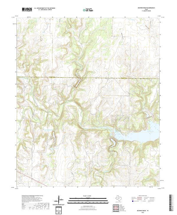
2022 Map of McEwen Draw
USGS Topo · Published 2022About this map
Lake Coleman dominates the eastern edge of this landscape, where the waters of Jim Ned Creek and Rough Creek converge. The terrain is defined by the sharp incisions of local drainages, most notably the namesake McEwen Draw in the north and the deep corridor of Long Hollow in the west. This area of central Texas, straddling the boundary between Callahan and Coleman counties, shows a sparse ranching and rural network connected by routes such as FM 482 and Co RD 247. Water management is a critical feature of the local geography, evidenced by the Soil Conservation Service Site 12f Reservoir and Hudson Lake, which support the agricultural needs of the high-plains landscape. The map also traces the headwaters of several streams, including Crooked Cr and Clear Cr, moving through the undulating topography.
Find a feature on this map
26 named features on this map. Tap any name to fly to it.
Don’t see what you’re looking for? This feature index may not catch every label — zoom into the map to look around manually.
Map Details
Editions of this 2022 McEwen Draw Map
This is the sole edition of this map. No revisions or reprints were ever made.
Other maps of this area

1887 · Coleman
USGS Topo · 1:125,000

1889 · Coleman
USGS Topo · 1:125,000

1890 · Abilene
USGS Topo · 1:125,000

1892 · Abilene
USGS Topo · 1:125,000

1892 · Ballinger
USGS Topo · 1:125,000

1931 · Baird
USGS Topo · 1:125,000

1932 · Baird
USGS Topo · 1:125,000

1954 · Brownwood
USGS Topo · 1:250,000

1954 · Abilene
USGS Topo · 1:250,000

1958 · Abilene
USGS Topo · 1:250,000