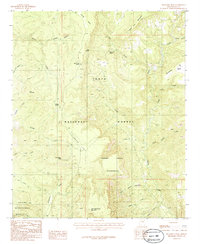
1986 Map of McFadden Peak
USGS Topo · Published 1986About this map
Tonto National Forest defines this high-elevation landscape in Gila County, where the dramatic topography of the Sierra Ancha Wilderness meets the drainages of Cherry Creek and Salome Creek. This mid-1980s provisional survey highlights a terrain of isolated mesas and high saddles, such as Pendleton Mesa and Board Tree Saddle, long before modern development altered these remote reaches.
Find a feature on this map
30 named features on this map. Tap any name to fly to it.
Don’t see what you’re looking for? This feature index may not catch every label — zoom into the map to look around manually.
Map Details
Editions of this 1986 McFadden Peak Map
2 editions found
Other maps of this area

1886 · Holbrook
USGS Topo · 1:250,000

1887 · Verde
USGS Topo · 1:250,000

1892 · Verde
USGS Topo · 1:250,000

1893 · Holbrook
USGS Topo · 1:250,000

1907 · Roosevelt
USGS Topo · 1:125,000

1909 · Four Peaks
USGS Topo · 1:125,000

1912 · Roosevelt
USGS Topo · 1:125,000

1922 · Chrysotile
USGS Topo · 1:125,000

1937 · Diamond Butte
USGS Topo · 1:48,000

1943 · Diamond Butte
USGS Topo · 1:62,500