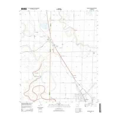
2014 Map of McGehee North
USGS Topo · Published 2014About this map
Bayou Bartholomew meanders through this portion of the Arkansas Delta, defining the low-lying terrain along the border of Drew and Desha Counties. This 2014 survey captures the agricultural and transportation corridors of the region, anchored by the settlements of Tillar, Reed, and the northern edge of McGehee. The presence of numerous burial grounds, including Bogue Pilgrim Cem, Seven Star Cem, and McCool Cem, provides significant genealogical value, marking the historical footprint of rural communities and family estates. The landscape is interconnected by the Us-165 corridor and the Old Tillar Hwy, following the natural drainage patterns of Crooked Bayou and Little Bayou Macon. Regional aviation is represented by Tillar Airport and the Flying G Ranch Airport, while the legacy of rail transport remains visible through the alignment of N Railroad St and S Railroad St in Tillar.
Find a feature on this map
69 named features on this map. Tap any name to fly to it.
Don’t see what you’re looking for? This feature index may not catch every label — zoom into the map to look around manually.
Map Details
Editions of this 2014 McGehee North Map
This is the sole edition of this map. No revisions or reprints were ever made.
Other maps of this area

1935 · Cominto
USGS Topo · 1:62,500

1935 · Rotan
USGS Topo · 1:62,500

1935 · Red Fork
USGS Topo · 1:62,500

1936 · McGehee
USGS Topo · 1:62,500

1937 · McGehee
USGS Topo · 1:62,500

1953 · Greenwood
USGS Topo · 1:250,000

1955 · McGehee
USGS Topo · 1:62,500

1956 · Greenwood
USGS Topo · 1:250,000

1960 · Selma
USGS Topo · 1:24,000

1960 · Collins
USGS Topo · 1:24,000