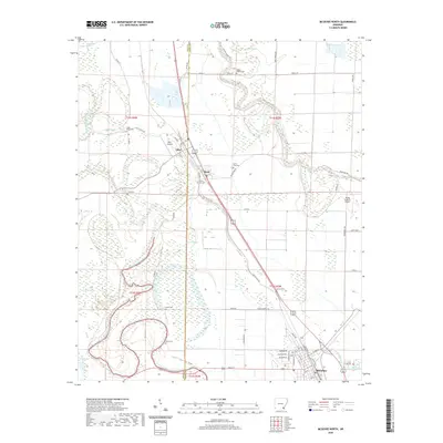
2020 Map of McGehee North
USGS Topo · Published 2020About this map
Bayou Bartholomew meanders through the heart of the Arkansas Delta, defining a landscape of wetlands and established agricultural communities at the border of Drew and Desha counties. The town of Tillar serves as a local hub, situated near several smaller settlements including Reed and the northern outskirts of McGehee. This map captures a dense network of local history, preserved in its numerous rural burial grounds such as Seven Star Cem, Austin Cem, and Bogue Pilgrim Cem. The low-lying terrain is punctuated by a series of distinct brakes and bayous, including Coon Bayou Brake, Loggy Bayou, and Paw Paw Brake, illustrating the complex hydrography that has shaped the region's development. Transportation is anchored by the Old Tillar Hwy and local aviation facilities like Tillar Airport and Flying G Ranch Airport.
Find a feature on this map
74 named features on this map. Tap any name to fly to it.
Don’t see what you’re looking for? This feature index may not catch every label — zoom into the map to look around manually.
Map Details
Editions of this 2020 McGehee North Map
This is the sole edition of this map. No revisions or reprints were ever made.
Other maps of this area

1935 · Cominto
USGS Topo · 1:62,500

1935 · Rotan
USGS Topo · 1:62,500

1935 · Red Fork
USGS Topo · 1:62,500

1936 · McGehee
USGS Topo · 1:62,500

1937 · McGehee
USGS Topo · 1:62,500

1953 · Greenwood
USGS Topo · 1:250,000

1955 · McGehee
USGS Topo · 1:62,500

1956 · Greenwood
USGS Topo · 1:250,000

1960 · Selma
USGS Topo · 1:24,000

1960 · Collins
USGS Topo · 1:24,000