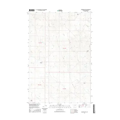
2017 Map of McGinnis Butte
USGS Topo · Published 2017About this map
McGinnis Butte stands as a primary landmark in this section of Garfield County, marking a landscape defined by the intricate drainages of the Missouri River basin. The geography is characterized by a network of seasonal watercourses and coulees, including Peterson Coulee and Day Coulee, which carve through the high plains. Vital water sources like Peterson Spring supported the early ranching operations that shaped this part of Montana. The land is divided by the Public Land Survey System into townships like t14n r34e, while transportation is limited to established routes such as Ingamar Rd and 17235 Rd. Along the southern edge, Gumbo Ridge rises above the valley of Little McGinnis Cr, illustrating the clay-heavy soils that give the ridge its name.
Find a feature on this map
17 named features on this map. Tap any name to fly to it.
Don’t see what you’re looking for? This feature index may not catch every label — zoom into the map to look around manually.
Map Details
Editions of this 2017 McGinnis Butte Map
This is the sole edition of this map. No revisions or reprints were ever made.
Other maps of this area
1954 · Jordan
USGS Topo · 1:250,000

1954 · Forsyth
USGS Topo · 1:250,000
1956 · Jordan
USGS Topo · 1:250,000

1957 · Forsyth
USGS Topo · 1:250,000
1958 · Jordan
USGS Topo · 1:250,000

1958 · Forsyth
USGS Topo · 1:250,000
1963 · Mc Williams Springs
USGS Topo · 1:24,000
1963 · Regnal Coulee
USGS Topo · 1:24,000
1964 · Jordan
USGS Topo · 1:250,000
1965 · Robertson School
USGS Topo · 1:24,000