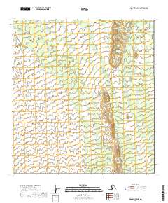
2019 Map of McGrath C-3 NE
USGS Topo · Published 2019About this map
Sullivan Creek and Bear Creek dominate the drainage patterns of this interior Alaskan landscape within the Yukon-Koyukuk Census Area. The topography is defined by the winding paths of Sheep Creek as it meanders through the central and southern portions of the quadrangle. This 2019 survey provides a precise look at the township and range divisions, including t31n r26w and t30n r26w, where the natural hydrologic features serve as the primary landmarks in an otherwise unsettled territory. The map illustrates the complex network of minor tributaries feeding into Sheep Creek, revealing the intricate water-carved terrain of the McGrath C-3 NE region.
Find a feature on this map
13 named features on this map. Tap any name to fly to it.
Don’t see what you’re looking for? This feature index may not catch every label — zoom into the map to look around manually.
Map Details
Editions of this 2019 McGrath C-3 NE Map
This is the sole edition of this map. No revisions or reprints were ever made.
Other maps of this area

1949 · McGrath
USGS Topo · 1:250,000

1950 · McGrath
USGS Topo · 1:250,000

1954 · McGrath D-3
USGS Topo · 1:63,360

1954 · McGrath C-3
USGS Topo · 1:63,360

1958 · McGrath D-2
USGS Topo · 1:63,360

1958 · McGrath C-2
USGS Topo · 1:63,360

1958 · McGrath
USGS Topo · 1:250,000
2019 · McGrath C-2 SW
USGS Topo · 1:25,000
2019 · McGrath D-3 SW
USGS Topo · 1:25,000
2019 · McGrath C-3 NW
USGS Topo · 1:25,000