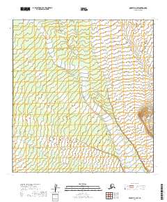
2019 Map of McGrath C-3 SW
USGS Topo · Published 2019About this map
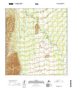
The Windy Fork Middle Fork Kuskokwim River and Pitka Fork Middle Fork Kuskokwim River define the intricate drainage patterns of this remote interior Alaska landscape. These braided river systems, characterized by shifting gravel bars and seasonal flow variations, dominate the central and eastern portions of the quadrangle. In the southern reach, the smaller Khuchaynik Cr feeds into this aquatic network, highlighting the area's role as a primary watershed within the Yukon-Koyukuk region. This 2019 survey documents a landscape devoid of permanent settlements or roads, illustrating the pristine state of the Alaskan bush. The map serves as a detailed record of natural topography and hydrography for environmental researchers or those mapping the drainage of the Kuskokwim River's middle forks.
Find a feature on this map
7 named features on this map. Tap any name to fly to it.
Don’t see what you’re looking for? This feature index may not catch every label — zoom into the map to look around manually.
Map Details
Editions of this 2019 McGrath C-3 SW Map
This is the sole edition of this map. No revisions or reprints were ever made.
Other maps of this area

1949 · McGrath
USGS Topo · 1:250,000

1950 · McGrath
USGS Topo · 1:250,000

1953 · McGrath C-4
USGS Topo · 1:63,360

1954 · McGrath B-4
USGS Topo · 1:63,360

1954 · McGrath C-3
USGS Topo · 1:63,360
1958 · McGrath B-3
USGS Topo · 1:63,360

1958 · McGrath
USGS Topo · 1:250,000
2019 · McGrath C-3 NW
USGS Topo · 1:25,000
2019 · McGrath C-3 SE
USGS Topo · 1:25,000
2019 · McGrath C-4 SE
USGS Topo · 1:25,000