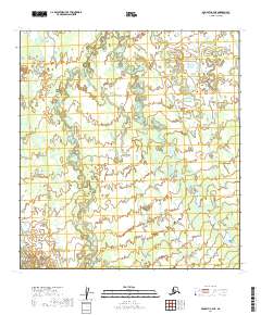
2019 Map of McGrath C-4 NE
USGS Topo · Published 2019About this map
The Middle Fork Kuskokwim River and its tributary, the Windy Fork Middle Fork Kuskokwim River, dominate this interior Alaska landscape. These braided waterways exhibit complex meandering patterns, with numerous oxbows and relic channels visible throughout the drainage basin. This 2019 survey documents a wilderness area largely devoid of permanent settlements or infrastructure, defined instead by the shifting hydrology of the Kuskokwim system. The topographic data captures the subtle elevation changes of the river valley as it transitions across the township boundaries of t31n r29w, t30n r29w, and t29n r29w. Researchers of hydrological change and remote Alaskan terrain can use this data to trace the evolution of the river's path through this uninhabited reach of the Yukon-Koyukuk Census Area.
Find a feature on this map
8 named features on this map. Tap any name to fly to it.
Don’t see what you’re looking for? This feature index may not catch every label — zoom into the map to look around manually.
Map Details
Editions of this 2019 McGrath C-4 NE Map
This is the sole edition of this map. No revisions or reprints were ever made.
Other maps of this area

1949 · McGrath
USGS Topo · 1:250,000

1950 · McGrath
USGS Topo · 1:250,000

1953 · McGrath C-4
USGS Topo · 1:63,360

1953 · McGrath D-4
USGS Topo · 1:63,360

1954 · McGrath D-3
USGS Topo · 1:63,360

1954 · McGrath C-3
USGS Topo · 1:63,360

1958 · McGrath
USGS Topo · 1:250,000
2019 · McGrath D-3 SW
USGS Topo · 1:25,000
2019 · McGrath C-4 NW
USGS Topo · 1:25,000
2019 · McGrath C-3 NW
USGS Topo · 1:25,000