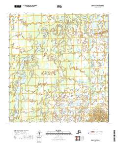
2019 Map of McGrath C-4 NW
USGS Topo · Published 2019About this map
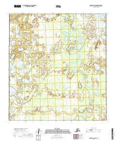
The Big River meanders through this remote portion of the Yukon-Koyukuk region, defining a landscape of complex oxbows and shifting wetlands. This 2019 survey documents the river's path as it winds across the interior plains, revealing the natural hydrology of the area within T31n R30w and T30n R31w. The terrain is characterized by a dense network of small ponds and river loops that illustrate the dynamic nature of Alaskan waterways. While devoid of named settlements or infrastructure, the map provides precise section and township boundaries for the surrounding wilderness, including T29n R30w, making it a critical reference for understanding the physical geography and land divisions in this part of the Alaska interior.
Find a feature on this map
10 named features on this map. Tap any name to fly to it.
Don’t see what you’re looking for? This feature index may not catch every label — zoom into the map to look around manually.
Map Details
Editions of this 2019 McGrath C-4 NW Map
This is the sole edition of this map. No revisions or reprints were ever made.
Other maps of this area

1949 · McGrath
USGS Topo · 1:250,000

1950 · McGrath
USGS Topo · 1:250,000

1953 · McGrath D-5
USGS Topo · 1:63,360

1953 · McGrath C-4
USGS Topo · 1:63,360

1953 · McGrath D-4
USGS Topo · 1:63,360
1955 · McGrath C-5
USGS Topo · 1:63,360

1958 · McGrath
USGS Topo · 1:250,000
2019 · McGrath C-5 NE
USGS Topo · 1:25,000
2019 · McGrath D-5 SE
USGS Topo · 1:25,000
2019 · McGrath D-4 SW
USGS Topo · 1:25,000