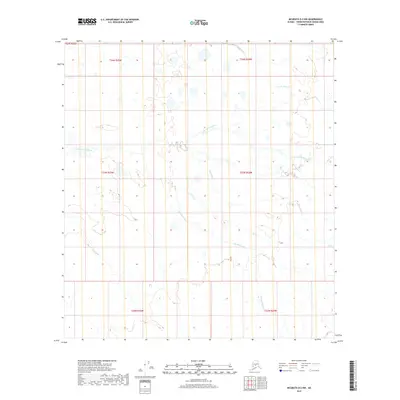
2019 Map of McGrath D-2 NW
USGS Topo · Published 2019About this map
Little Tonzona River meanders across this interior Alaskan landscape, defining the hydrology of a region where water and wilderness converge. This 2019 survey captures a complex network of glacial and runoff-fed waterways, including the winding Big Salmon Fork and the tributaries of the S Fork Jones Cr. The terrain is marked by subtle elevation changes and numerous unnamed ponds, characteristic of the Yukon-Koyukuk region. In addition to major river systems, smaller drainage features like Deepbank Cr, Clear Fork, and the curiously named No Cr illustrate the intricate natural irrigation of this roadless environment. The map provides a high-resolution view of the natural topography and township boundaries, such as t34n r24w, essential for researchers studying the remote hydrology of the Alaskan interior before modern environmental shifts.
Find a feature on this map
13 named features on this map. Tap any name to fly to it.
Don’t see what you’re looking for? This feature index may not catch every label — zoom into the map to look around manually.
Map Details
Editions of this 2019 McGrath D-2 NW Map
This is the sole edition of this map. No revisions or reprints were ever made.
Other maps of this area

1949 · McGrath
USGS Topo · 1:250,000

1950 · Medfra
USGS Topo · 1:250,000

1950 · McGrath
USGS Topo · 1:250,000

1954 · McGrath D-3
USGS Topo · 1:63,360

1954 · Medfra A-3
USGS Topo · 1:63,360

1958 · McGrath D-2
USGS Topo · 1:63,360

1958 · Medfra A-2
USGS Topo · 1:63,360

1958 · McGrath
USGS Topo · 1:250,000

1959 · Medfra
USGS Topo · 1:250,000
2019 · McGrath D-2 SE
USGS Topo · 1:25,000