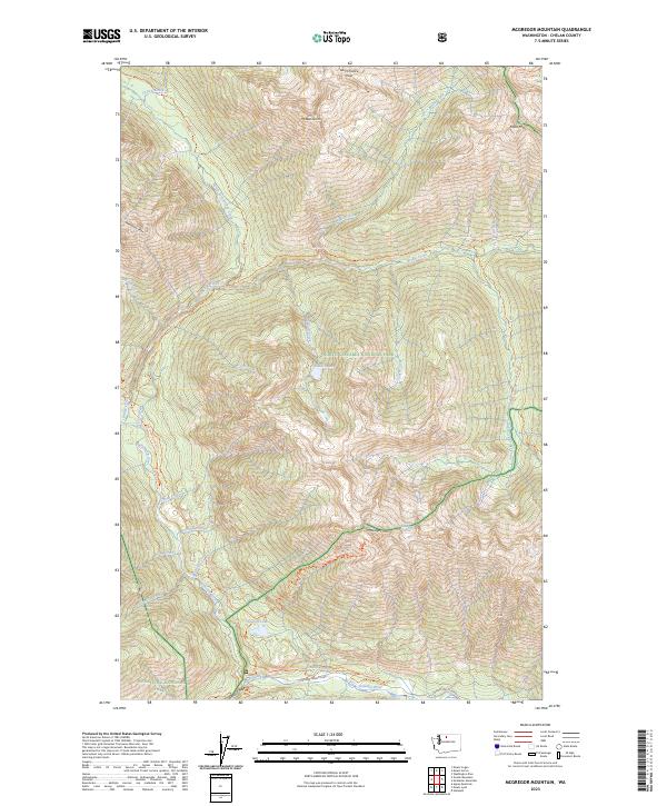
2023 Map of McGregor Mountain
USGS Topo · Published 2023About this map
McGregor Mtn stands as a prominent landmark at the center of this high-elevation mountain landscape, where the North Cascades National Park meets the Wenatchee National Forest. The map documents a complex drainage system defining the alpine terrain, characterized by the Sandalee Glacier and numerous high-mountain streams like Grizzly Creek and North Fork Bridge Creek. The Stehekin Valley Road and the Stehekin River trace the southern valley floor, providing a vital corridor through the protected areas of the Stephen Mather Wilderness and Glacier Peak Wilderness. This survey captures the connectivity of remote wilderness paths, including a significant stretch of the Pacific Crest National Scenic Trail as it traverses the ridges. Notable features for explorers and researchers include Last Chance Pass, the waters of Howard Lake, and various forest routes such as the McGregor Mountain Trail and Agnes Gorge Trail.
Find a feature on this map
47 named features on this map. Tap any name to fly to it.
Don’t see what you’re looking for? This feature index may not catch every label — zoom into the map to look around manually.
Map Details
Editions of this 2023 McGregor Mountain Map
This is the sole edition of this map. No revisions or reprints were ever made.
Other maps of this area

1902 · Stehekin
USGS Topo · 1:125,000

1904 · Stehekin
USGS Topo · 1:125,000

1920 · Slate Pass
USGS Topo · 1:125,000

1955 · Concrete
USGS Topo · 1:250,000

1958 · Concrete
USGS Topo · 1:250,000

1962 · Concrete
USGS Topo · 1:250,000

1963 · Washington Pass
USGS Topo · 1:24,000

1963 · Mc Gregor Mtn
USGS Topo · 1:24,000
1963 · Agnes Mtn
USGS Topo · 1:24,000
1963 · Mt. Arriva
USGS Topo · 1:24,000