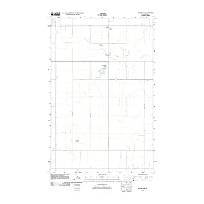
2011 Map of McGregor
USGS Topo · Published 2011About this map
The small settlement of McGregor anchors this part of Williams County, sitting at the junction of County Hwy-16 and 105th Ave NW. This high plains landscape is defined by the winding course of White Earth Creek, which flows southeast past several burial grounds including Sharon Cemetery, Zion Cemetery, and Saint Marys Cemetery. These sites provide significant genealogical markers for the rural community during this era.
Find a feature on this map
24 named features on this map. Tap any name to fly to it.
Don’t see what you’re looking for? This feature index may not catch every label — zoom into the map to look around manually.
Map Details
Editions of this 2011 McGregor Map
This is the sole edition of this map. No revisions or reprints were ever made.
Other maps of this area

1911 · Ray
USGS Topo · 1:125,000

1953 · Williston
USGS Topo · 1:250,000

1957 · Williston
USGS Topo · 1:250,000

1969 · White Earth
USGS Topo · 1:24,000

1974 · Hamlet
USGS Topo · 1:24,000

1974 · McGregor
USGS Topo · 1:24,000

1974 · Grand View
USGS Topo · 1:24,000
1974 · Bush Lake
USGS Topo · 1:24,000

1974 · Big Meadow
USGS Topo · 1:24,000

1978 · Battleview
USGS Topo · 1:24,000