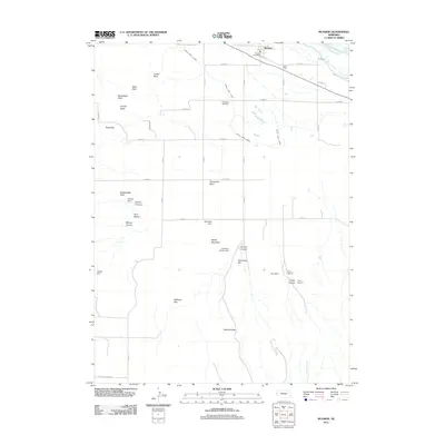
2011 Map of McGrew
USGS Topo · Published 2011About this map
The North Platte River flows through the northern reaches of this landscape, supporting a complex network of water management features essential to the region's agricultural character. The Castle Rock Canal and several irrigation structures, including Birchfield Dam and Horn Dam, illustrate the intensive engineering used to manage the valley's water resources. The village of McGrew serves as the local hub, anchored by the McGrew Post Office, while the High Butte Cemetery stands as a quiet record of the area's residents.
Find a feature on this map
36 named features on this map. Tap any name to fly to it.
Don’t see what you’re looking for? This feature index may not catch every label — zoom into the map to look around manually.
Map Details
Editions of this 2011 McGrew Map
This is the sole edition of this map. No revisions or reprints were ever made.
Other maps of this area

1898 · Scotts Bluff
USGS Topo · 1:125,000

1898 · Camp Clarke
USGS Topo · 1:125,000

1954 · Scottsbluff
USGS Topo · 1:250,000

1958 · Scottsbluff
USGS Topo · 1:250,000

1965 · Minatare
USGS Topo · 1:24,000

1965 · Bayard
USGS Topo · 1:24,000

1965 · South Bayard
USGS Topo · 1:24,000

1965 · Bayard SW
USGS Topo · 1:24,000

1965 · McGrew
USGS Topo · 1:24,000

1973 · Scotts Bluff 4 SE
USGS Topo · 1:24,000