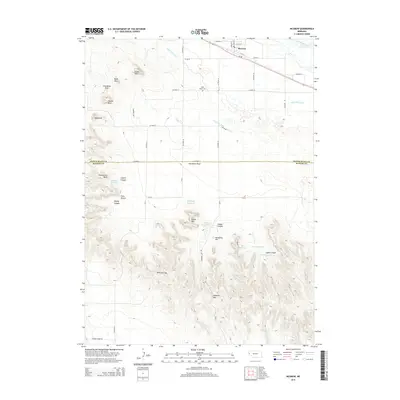
2014 Map of McGrew
USGS Topo · Published 2014About this map
The North Platte River flows through the northern edge of this Nebraska landscape, where the village of McGrew sits at the intersection of Ne-92 and Main St. The terrain is defined by a series of dramatic elevations and named landmarks that dominate the horizon south of the river valley. Distinctive formations such as Castle Rock, Steamboat Rock, and Smokestack Rock provide clear navigational markers for researchers and historians.
Find a feature on this map
51 named features on this map. Tap any name to fly to it.
Don’t see what you’re looking for? This feature index may not catch every label — zoom into the map to look around manually.
Map Details
Editions of this 2014 McGrew Map
This is the sole edition of this map. No revisions or reprints were ever made.
Other maps of this area
1898 · Scotts Bluff
USGS Topo · 1:125,000
1898 · Camp Clarke
USGS Topo · 1:125,000
1954 · Scottsbluff
USGS Topo · 1:250,000
1958 · Scottsbluff
USGS Topo · 1:250,000
1965 · Minatare
USGS Topo · 1:24,000
1965 · Bayard
USGS Topo · 1:24,000
1965 · South Bayard
USGS Topo · 1:24,000
1965 · Bayard SW
USGS Topo · 1:24,000
1965 · McGrew
USGS Topo · 1:24,000
1973 · Scotts Bluff 4 SE
USGS Topo · 1:24,000