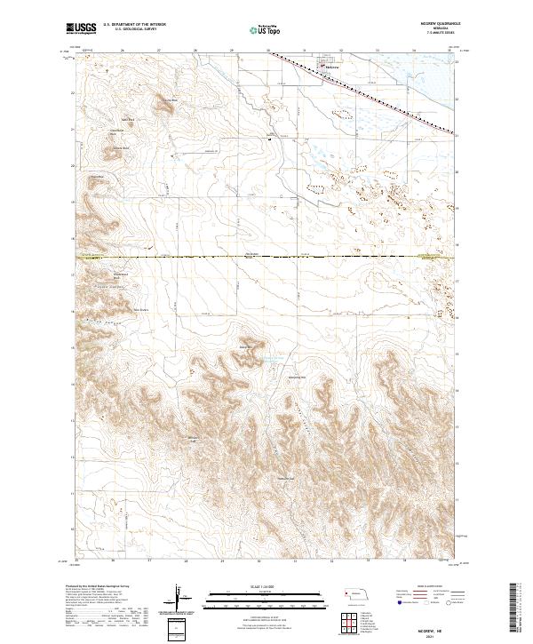
2021 Map of McGrew
USGS Topo · Published 2021About this map
McGrew sits on the southern banks of the North Platte River, serving as a focal point for the agricultural landscape of western Nebraska. The area is defined by a sophisticated irrigation network, with the Castle Rock Canal drawing water toward the fields surrounding the town. To the south, the terrain shifts abruptly from the river valley into a series of dramatic buttes and canyons along the Scotts Bluff Co Banner Co line. Landmarks such as Steamboat Rock, Castle Rock, and the Twin Sisters rise above the plains, providing distinct navigational points for generations. Genealogists and local historians can locate the High Butte Cem north of the county line, while the southern reaches of the map reveal a more isolated landscape of gaps and canyons, including Hubbard Gap and the winding Logan Canyon near Pumpkin Creek.
Find a feature on this map
40 named features on this map. Tap any name to fly to it.
Don’t see what you’re looking for? This feature index may not catch every label — zoom into the map to look around manually.
Map Details
Editions of this 2021 McGrew Map
This is the sole edition of this map. No revisions or reprints were ever made.
Other maps of this area

1898 · Scotts Bluff
USGS Topo · 1:125,000

1898 · Camp Clarke
USGS Topo · 1:125,000

1954 · Scottsbluff
USGS Topo · 1:250,000

1958 · Scottsbluff
USGS Topo · 1:250,000

1965 · Minatare
USGS Topo · 1:24,000

1965 · Bayard
USGS Topo · 1:24,000

1965 · South Bayard
USGS Topo · 1:24,000

1965 · Bayard SW
USGS Topo · 1:24,000

1965 · McGrew
USGS Topo · 1:24,000

1973 · Scotts Bluff 4 SE
USGS Topo · 1:24,000