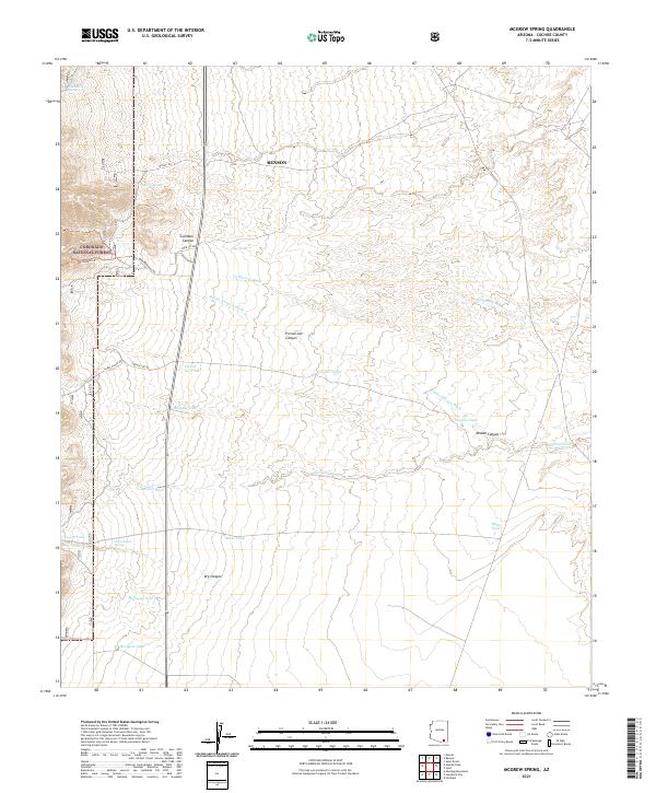
2021 Map of McGrew Spring
USGS Topo · Published 2021About this map
Coronado National Forest defines the western edge of this landscape, where the Guindani Trl winds through the high relief of Guindani Canyon. This desert environment is characterized by a sophisticated system of water management and natural drainage, with various washes and tanks serving the arid terrain. Arroyos like California Wash, Middle Canyon Wash, and the extensive Sacaton Wash cut through the alluvial plains, while human-made and natural catchments like Jog Tank, Ramsey Tank, and Mesquite Tank provide critical water points. The map reflects a landscape of ranching and conservation, where primitive routes such as Sands Ranch Rd and French Joe Rd provide access to the foothills of French Joe Canyon and the secluded McGrew Spring.
Find a feature on this map
31 named features on this map. Tap any name to fly to it.
Don’t see what you’re looking for? This feature index may not catch every label — zoom into the map to look around manually.
Map Details
Editions of this 2021 McGrew Spring Map
This is the sole edition of this map. No revisions or reprints were ever made.
Other maps of this area

1915 · Benson
USGS Topo · 1:125,000

1922 · St. David
USGS Topo · 1:62,500

1926 · Whetstone
USGS Topo · 1:62,500

1932 · Fairbank
USGS Topo · 1:62,500

1938 · Huachuca
USGS Topo · 1:62,500

1943 · Benson
USGS Topo · 1:125,000

1948 · Fort Huachuca NE
USGS Topo · 1:24,000
1948 · Mustang Mountains
USGS Topo · 1:24,000
1948 · Fort Huachuca
USGS Topo · 1:62,500
1952 · Fairbank
USGS Topo · 1:24,000