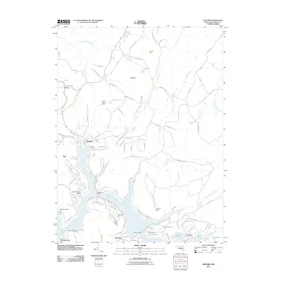
2011 Map of McHenry
USGS Topo · Published 2011About this map
The settlement of McHenry sits at the northern reach of Deep Creek, a central focus of this Garrett County landscape. By 2011, the area around the reservoir shows significant development including the McHenry Post Office and the Garrett County Airport. The terrain is punctuated by significant rises such as Negro Mountain, Roman Nose Hill, and George Hill, while the water system is fed by numerous tributaries including Cherry Creek, Bear Creek, and Gravelly Run.
Find a feature on this map
114 named features on this map. Tap any name to fly to it.
Don’t see what you’re looking for? This feature index may not catch every label — zoom into the map to look around manually.
Map Details
Editions of this 2011 McHenry Map
This is the sole edition of this map. No revisions or reprints were ever made.
Other maps of this area

1895 · Piedmont
USGS Topo · 1:125,000

1899 · Grantsville
USGS Topo · 1:62,500

1899 · Oakland
USGS Topo · 1:62,500

1900 · Accident
USGS Topo · 1:62,500

1900 · Oakland
USGS Topo · 1:62,500

1904 · Grantsville
USGS Topo · 1:62,500

1919 · Elk Garden
USGS Topo · 1:48,000

1920 · Elk Garden
USGS Topo · 1:48,000

1922 · Elk Garden
USGS Topo · 1:62,500

1946 · Grantsville
USGS Topo · 1:24,000