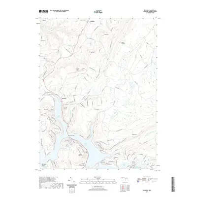
2019 Map of McHenry
USGS Topo · Published 2019About this map
Deep Creek Lake dominates the central landscape, defining the character of western Maryland's mountain country near McHenry and Thayerville. This 2019 survey documents the extensive shoreline development and recreational infrastructure, including Deep Creek State Park and several coves like Marsh Run Cove and Red Run Cove. The high ridges of Negro Mountain and Meadow Mtn flank the valley, while the northern reaches of the quadrangle include the curiously named settlement of Accident. Genealogists will find several burial sites preserved in the topographic data, such as Hoyes Cem, Deep Creek Cem, and Glendale Cem. The transition from the aviation activity at Garrett County Airport to the wetland terrain of The Glades illustrates the varied land use of this Garrett County corridor.
Find a feature on this map
135 named features on this map. Tap any name to fly to it.
Don’t see what you’re looking for? This feature index may not catch every label — zoom into the map to look around manually.
Map Details
Editions of this 2019 McHenry Map
This is the sole edition of this map. No revisions or reprints were ever made.
Other maps of this area

1895 · Piedmont
USGS Topo · 1:125,000

1899 · Grantsville
USGS Topo · 1:62,500

1899 · Oakland
USGS Topo · 1:62,500

1900 · Accident
USGS Topo · 1:62,500

1900 · Oakland
USGS Topo · 1:62,500

1904 · Grantsville
USGS Topo · 1:62,500

1919 · Elk Garden
USGS Topo · 1:48,000

1920 · Elk Garden
USGS Topo · 1:48,000

1922 · Elk Garden
USGS Topo · 1:62,500

1946 · Grantsville
USGS Topo · 1:24,000