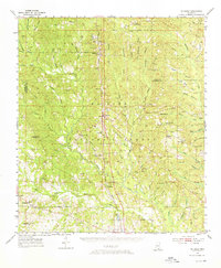
1954 Map of McHenry
USGS Topo · Published 1976About this map
McHenry and Saucier anchor this mid-century view of the central Mississippi piney woods, where the Illinois Central railroad dictates the pattern of settlement through the De Soto National Forest. The landscape is a network of small family-named cemeteries and rural institutions, such as Yellow Fever Cem and Wedgeworth Cem, which reflect the localized history of Harrison and Stone counties. The topography is defined by the winding Biloxi River and numerous tributaries like Rattlesnake Branch, supporting a mix of conservation and resource management visible at the Experimental Forest Headquarters and the Fish Hatchery. Small rural schools like Advance Sch and churches such as Sunflower Ch illustrate the community structure in the era before widespread consolidation, while features like the Gundlach Lookout Tower speak to the region's active fire observation network.
Find a feature on this map
78 named features on this map. Tap any name to fly to it.
Don’t see what you’re looking for? This feature index may not catch every label — zoom into the map to look around manually.
Map Details
Editions of this 1954 McHenry Map
3 editions found
Other maps of this area

1947 · Wiggins
USGS Topo · 1:62,500

1947 · Benndale
USGS Topo · 1:62,500

1949 · Wiggins
USGS Topo · 1:62,500

1949 · Benndale
USGS Topo · 1:62,500

1953 · Mobile
USGS Topo · 1:250,000

1954 · Vestry
USGS Topo · 1:62,500

1954 · McHenry
USGS Topo · 1:62,500

1954 · Gulfport North
USGS Topo · 1:24,000

1954 · Biloxi
USGS Topo · 1:24,000

1954 · Biloxi
USGS Topo · 1:62,500