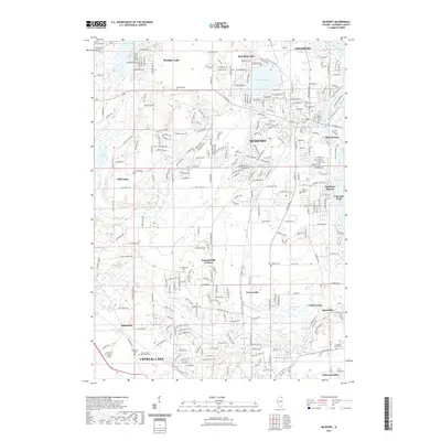
2021 Map of McHenry
USGS Topo · Published 2021About this map
Crystal Lake and the Mchenry corridor are defined by the winding course of the Fox River and a dense network of suburban development in this early 21st-century study. The map illustrates a landscape where residential communities like Johnsburg, Wonder Lake, and McHenry Shores wrap around significant glacial water bodies. The presence of numerous historical burial grounds, including the Ostend Cem and Saint Marys Cem, provides a clear view of the older rural settlement patterns that predated the modern sprawl. Educational and recreational hubs are prominent, from the McHenry County College campus to the sprawling Crystal Lake Memorial Park. Notable transit routes and small hubs like Holcombville Corners and Terra Cotta reflect the area's transition from a collection of distinct villages into a contiguous suburban region. The varied terrain of Bull Valley and the smaller drainages of Boone Cr and Dutch Cr continue to shape the local geography amidst increasing urbanization.
Find a feature on this map
130 named features on this map. Tap any name to fly to it.
Don’t see what you’re looking for? This feature index may not catch every label — zoom into the map to look around manually.
Map Details
Editions of this 2021 McHenry Map
This is the sole edition of this map. No revisions or reprints were ever made.
Other maps of this area

1920 · Grays Lake
USGS Topo · 1:62,500

1923 · Grays Lake
USGS Topo · 1:62,500

1923 · Barrington
USGS Topo · 1:62,500

1925 · Elgin
USGS Topo · 1:62,500

1926 · Mc Henry
USGS Topo · 1:62,500

1935 · Barrington
USGS Topo · 1:62,500

1940 · Elgin
USGS Topo · 1:62,500

1944 · McHenry
USGS Topo · 1:62,500

1954 · Rockford
USGS Topo · 1:250,000

1955 · Rockford
USGS Topo · 1:250,000