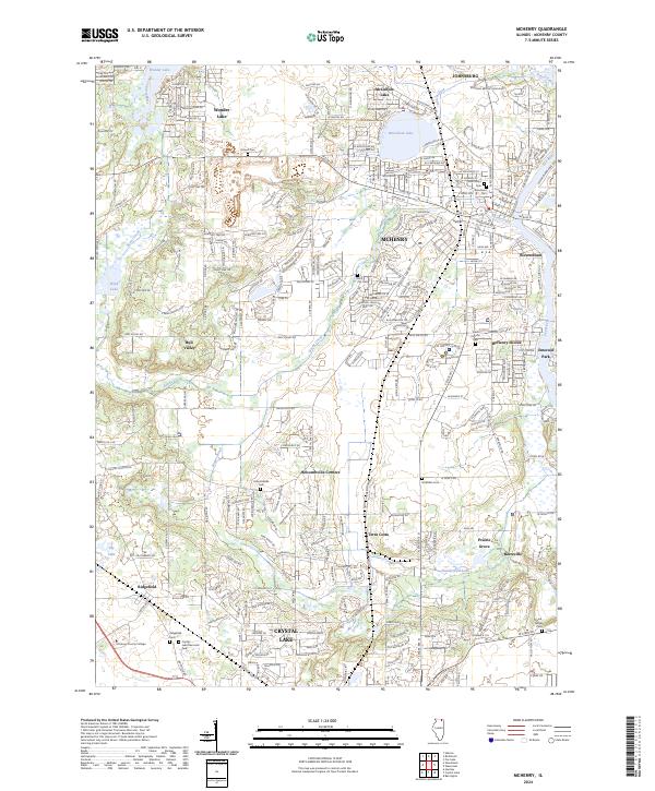
2024 Map of McHenry
USGS Topo · Published 2024About this map
McHenry and its surrounding Fox River communities are captured in this recent survey, showcasing a landscape where suburban growth meets the waterways of McHenry County. The Fox River serves as a central artery, winding past McHenry Shores, Riverstream, and Emerald Park. To the northwest, the large basin of Wonder Lake is ringed by residential developments, while McCullom Lake sits just north of the city center. Historical markers are frequent throughout the quadrangle, including numerous burial grounds like Holcombville Cem, Bluff City Cem, and Ostend Cem. These sites, along with smaller crossroads like Holcombville Corners and the industrial-named Terra Cotta, provide vital clues for local historians. Educational and recreational landmarks such as McHenry County College and Crystal Lake Memorial Park highlight the area's modern infrastructure within a geography still defined by glacial lakes and creek drainages like Boone Creek.
Find a feature on this map
113 named features on this map. Tap any name to fly to it.
Don’t see what you’re looking for? This feature index may not catch every label — zoom into the map to look around manually.
Map Details
Editions of this 2024 McHenry Map
This is the sole edition of this map. No revisions or reprints were ever made.
Other maps of this area

1920 · Grays Lake
USGS Topo · 1:62,500

1923 · Grays Lake
USGS Topo · 1:62,500

1923 · Barrington
USGS Topo · 1:62,500

1925 · Elgin
USGS Topo · 1:62,500

1926 · Mc Henry
USGS Topo · 1:62,500

1935 · Barrington
USGS Topo · 1:62,500

1940 · Elgin
USGS Topo · 1:62,500

1944 · McHenry
USGS Topo · 1:62,500

1954 · Rockford
USGS Topo · 1:250,000

1955 · Rockford
USGS Topo · 1:250,000