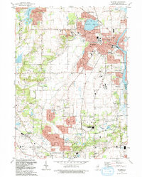
1992 Map of McHenry
USGS Topo · Published 1992About this map
The Fox River corridor serves as the primary artery for this region of McHenry County, anchoring a landscape where suburban expansion meets legacy rural tracts. In the city of Mc Henry, the local infrastructure is detailed through a dense network of educational and religious institutions, including St Joseph Seminary and multiple high schools like West Campus High Sch. To the south and west, the mapping captures the transition into smaller hamlets and distinctive areas like Bull Valley and Holcombville Corners, while the Chicago and North Western line provides the historical backbone for the region's commuter and industrial connectivity.
Find a feature on this map
62 named features on this map. Tap any name to fly to it.
Don’t see what you’re looking for? This feature index may not catch every label — zoom into the map to look around manually.
Map Details
Editions of this 1992 McHenry Map
This is the sole edition of this map. No revisions or reprints were ever made.
Other maps of this area

1920 · Grays Lake
USGS Topo · 1:62,500

1923 · Grays Lake
USGS Topo · 1:62,500

1923 · Barrington
USGS Topo · 1:62,500

1925 · Elgin
USGS Topo · 1:62,500

1926 · Mc Henry
USGS Topo · 1:62,500

1935 · Barrington
USGS Topo · 1:62,500

1940 · Elgin
USGS Topo · 1:62,500

1944 · McHenry
USGS Topo · 1:62,500

1954 · Rockford
USGS Topo · 1:250,000

1955 · Rockford
USGS Topo · 1:250,000