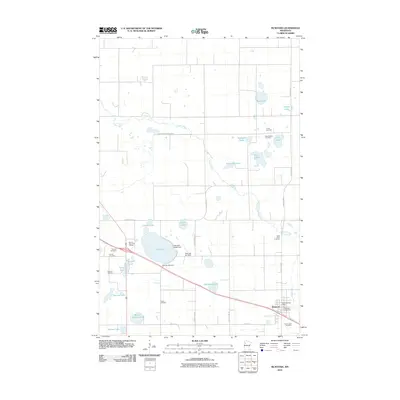
2010 Map of McIntosh
USGS Topo · Published 2010About this map
The settlement of McIntosh serves as the focal point for this section of Polk County, where the plains of northwestern Minnesota are dotted with numerous small glacial lakes and a winding Poplar River. The town center features the McIntosh Post Office and the City of McIntosh Campground, surrounded by a landscape organized around an extensive grid of county highways. Water management is a defining characteristic of the terrain, seen in the Poplar River Diversion Ditch and the Oak Lake Outlet Dam, which control the flow between bodies of water like Oak Lake and Clausen-Lake. Genealogists will find a significant concentration of burial grounds in the area, including Trinity Cemetery, New Sweden Cemetery, and Saint Johns Cemetery, many of which sit adjacent to the region's agricultural fields. Recreation and infrastructure are represented by the Win-E-Mac Golf Course and the Oak Lake Air Strip, illustrating the modern development of this rural community.
Find a feature on this map
38 named features on this map. Tap any name to fly to it.
Don’t see what you’re looking for? This feature index may not catch every label — zoom into the map to look around manually.
Map Details
Editions of this 2010 McIntosh Map
This is the sole edition of this map. No revisions or reprints were ever made.
Other maps of this area

1918 · Terrebonne
USGS Topo · 1:62,500

1919 · Grit
USGS Topo · 1:62,500

1919 · Valley
USGS Topo · 1:62,500

1952 · Grand Forks
USGS Topo · 1:250,000

1954 · Bemidji
USGS Topo · 1:250,000

1956 · Grand Forks
USGS Topo · 1:250,000

1957 · Bemidji
USGS Topo · 1:250,000

1958 · Bemidji
USGS Topo · 1:250,000

1964 · Brooks
USGS Topo · 1:24,000

1966 · Grand Forks
USGS Topo · 1:250,000