
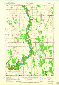
1964 Map of Brooks
USGS Topo · Published 1965About this map
Brooks serves as the primary hub of this Red Lake County landscape, positioned along the Soo Line railroad and the junction of State Highways 59 and 92. The geography is defined by a dense network of watercourses and managed drainage, featuring the winding Clearwater River to the north and the Poplar River cutting diagonally across the center. These natural channels are supplemented by an extensive system of man-made waterways, such as County Ditch No 17 and County Ditch No 4, reflecting the area's intensive agricultural development and efforts to manage the low-lying terrain.
Find a feature on this map
23 named features on this map. Tap any name to fly to it.
Don’t see what you’re looking for? This feature index may not catch every label — zoom into the map to look around manually.
Map Details
Editions of this 1964 Brooks Map
This is the sole edition of this map. No revisions or reprints were ever made.
Other maps of this area

1918 · Terrebonne
USGS Topo · 1:62,500

1919 · Grit
USGS Topo · 1:62,500

1919 · Valley
USGS Topo · 1:62,500

1952 · Grand Forks
USGS Topo · 1:250,000

1954 · Bemidji
USGS Topo · 1:250,000

1956 · Grand Forks
USGS Topo · 1:250,000

1957 · Bemidji
USGS Topo · 1:250,000

1958 · Bemidji
USGS Topo · 1:250,000
1964 · Plummer NW
USGS Topo · 1:24,000

1964 · Terrebonne
USGS Topo · 1:24,000