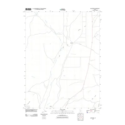
2010 Map of McIntyre
USGS Topo · Published 2010About this map
McIntyre and Jericho anchor this western Utah landscape, where the terrain transitions from the high elevations of Jericho Ridge into the broad expanse of the Tintic Valley. The map reveals a complex network of seasonal drainages and essential water sources that have historically dictated human activity in this arid region. Major ephemeral waterways like Death Creek, Tanner Creek, and Copperopolis Creek converge toward the valley floor, while localized water points such as Railroad Springs and Mud Springs suggest the historical importance of reliable water for livestock and transportation. Settled points like the Tintic Ranch and names like Diamond Gulch hint at the area's pastoral and mineral history. The infrastructure is characterized by simple routes like McIntyre Rd and Dennis Rd, reflecting a landscape defined more by its natural topography—including Chambers Wash and Riley Canyon—than by dense development.
Find a feature on this map
20 named features on this map. Tap any name to fly to it.
Don’t see what you’re looking for? This feature index may not catch every label — zoom into the map to look around manually.
Map Details
Editions of this 2010 McIntyre Map
This is the sole edition of this map. No revisions or reprints were ever made.
Other maps of this area

1885 · Sevier Desert
USGS Topo · 1:250,000

1949 · Eureka
USGS Topo · 1:24,000

1953 · Delta
USGS Topo · 1:250,000

1954 · Mc Intyre
USGS Topo · 1:24,000

1954 · Tintic Mountain
USGS Topo · 1:24,000

1954 · Tintic Junction
USGS Topo · 1:24,000
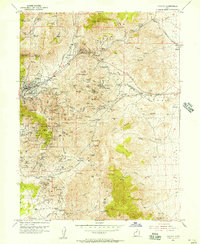
1954 · Eureka
USGS Topo · 1:24,000

1958 · Delta
USGS Topo · 1:250,000

1962 · Delta
USGS Topo · 1:250,000

1962 · Lynndyl
USGS Topo · 1:62,500