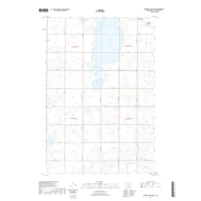
2017 Map of McKenna Lake South
USGS Topo · Published 2017About this map
Napoleon sits at the northern edge of this Logan County landscape, a central point of activity where the town's grid meets the surrounding prairie. This area is defined by its glacial depressions and water bodies, most notably the expansive McKenna Lake and the smaller Round Lake to its south. The presence of the Napoleon Municipal Airport on the northeastern outskirts indicates the town's role as a regional hub for transportation and transit. A consistent grid of sectional roads, including 64th St SE and 71st St SE, provides a rigid structure to the undulating terrain. To the southeast, the course of Beaver Cr cuts through the topography, representing the natural drainage patterns of this North Dakota high-plains environment during the early twenty-first century.
Find a feature on this map
17 named features on this map. Tap any name to fly to it.
Don’t see what you’re looking for? This feature index may not catch every label — zoom into the map to look around manually.
Map Details
Editions of this 2017 McKenna Lake South Map
This is the sole edition of this map. No revisions or reprints were ever made.
Other maps of this area

1953 · Jamestown
USGS Topo · 1:250,000

1956 · Jamestown
USGS Topo · 1:250,000

1975 · Kintyre
USGS Topo · 1:24,000

1979 · Schell Buttes
USGS Topo · 1:24,000

1979 · Schell Buttes SW
USGS Topo · 1:24,000

1979 · Schell Buttes NW
USGS Topo · 1:24,000

1979 · McKenna Lake South
USGS Topo · 1:24,000

1980 · McKenna Lake North
USGS Topo · 1:24,000

1982 · Wishek SW
USGS Topo · 1:24,000

1982 · Burnstad
USGS Topo · 1:24,000