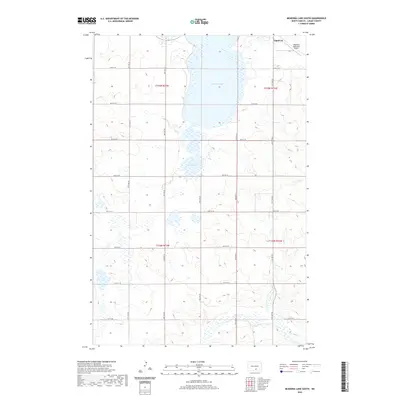
2020 Map of McKenna Lake South
USGS Topo · Published 2020About this map
McKenna Lake and Round Lake dominate the northern terrain of this Logan County survey, surrounded by a series of wetlands and seasonally flooded depressions. The town of Napoleon sits at the northeastern corner, characterized by its grid of local roads and the Napoleon Municipal Airport. This landscape is primarily shaped by the Missouri Plateau, where the drainage of Beaver Cr snakes through the southern sections. The map reveals a highly structured section-line road network, with routes like 67th St SE and 70th St SE providing access across the township lines of t135n r73w and t134n r72w. This grid highlights the agricultural organization of the region, where every square mile is accessible for farming and transport between the scattered lake basins.
Find a feature on this map
17 named features on this map. Tap any name to fly to it.
Don’t see what you’re looking for? This feature index may not catch every label — zoom into the map to look around manually.
Map Details
Editions of this 2020 McKenna Lake South Map
This is the sole edition of this map. No revisions or reprints were ever made.
Other maps of this area

1953 · Jamestown
USGS Topo · 1:250,000

1956 · Jamestown
USGS Topo · 1:250,000

1975 · Kintyre
USGS Topo · 1:24,000

1979 · Schell Buttes
USGS Topo · 1:24,000

1979 · Schell Buttes SW
USGS Topo · 1:24,000

1979 · Schell Buttes NW
USGS Topo · 1:24,000

1979 · McKenna Lake South
USGS Topo · 1:24,000

1980 · McKenna Lake North
USGS Topo · 1:24,000

1982 · Wishek SW
USGS Topo · 1:24,000

1982 · Burnstad
USGS Topo · 1:24,000