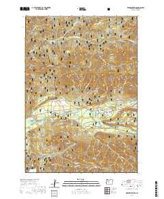
2020 Map of McKenzie Bridge
USGS Topo · Published 2020About this map
McKenzie Bridge and the nearby settlement of Rainbow serve as the primary human touchpoints in this 2020 landscape dominated by the Willamette National Forest. The geography is defined by the powerful convergence of the McKenzie River and its major tributaries, including Blue River, Horse Creek, and the waters flowing from Cougar Reservoir. Elevation plays a critical role here, with Lookout Ridge and the Cascade Range rising sharply above the river valleys. Local history and conservation efforts are evident in protected areas like the Lookout Creek Old Growth forest. Researchers will note how the modern route of 126 follows the river corridor, a path dictated by the steep terrain of landmarks such as King Castle, Castle Rock, and Lookout Mtn. The map provides a contemporary view of these Lane County communities before they face the shifting environmental impacts common to the high Cascades.
Find a feature on this map
58 named features on this map. Tap any name to fly to it.
Don’t see what you’re looking for? This feature index may not catch every label — zoom into the map to look around manually.
Map Details
Editions of this 2020 McKenzie Bridge Map
This is the sole edition of this map. No revisions or reprints were ever made.
Other maps of this area

1934 · Mc Kenzie Bridge
USGS Topo · 1:96,000

1940 · Mc Kenzie Bridge
USGS Topo · 1:125,000

1953 · Salem
USGS Topo · 1:250,000

1954 · Salem
USGS Topo · 1:250,000

1955 · Blue River
USGS Topo · 1:62,500

1955 · Cascadia
USGS Topo · 1:62,500

1955 · Echo Mountain
USGS Topo · 1:62,500

1955 · Mc Kenzie Bridge
USGS Topo · 1:62,500

1960 · Salem
USGS Topo · 1:250,000

1962 · Salem
USGS Topo · 1:250,000