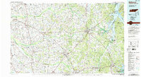
1986 Map of McKenzie
USGS Topo · Published 1993About this map
Kentucky Lake and the Tennessee River dominate the northeastern reaches of this West Tennessee landscape, where the Tennessee National Wildlife Refuge Big Sandy Unit and Paris Landing State Park anchor the shoreline. The terrain transitions from the river lowlands into a network of fertile drainages including the North Fork Obion River, Middle Fork Obion River, and South Fork Obion River. This 1980s-era study by the Tennessee Valley Authority captures the agricultural and transportation patterns of the region, from the Illinois Central Gulf RR corridor through South Fulton to smaller crossroad settlements like Dukedom, Latham, and Cottage Grove. The map also details extensive conservation and water management areas, including the Big Sandy Dewatering Area and West Sandy Wildlife Management Area.
Find a feature on this map
115 named features on this map. Tap any name to fly to it.
Don’t see what you’re looking for? This feature index may not catch every label — zoom into the map to look around manually.
Map Details
Editions of this 1986 McKenzie Map
3 editions found
Other maps of this area

1936 · Poplar Creek
USGS Topo · 1:24,000

1936 · Conyersville
USGS Topo · 1:24,000

1936 · Buchanan
USGS Topo · 1:24,000

1936 · Hazel
USGS Topo · 1:24,000

1936 · Tharpe
USGS Topo · 1:24,000

1936 · New Concord
USGS Topo · 1:24,000

1936 · Crossland
USGS Topo · 1:24,000

1936 · McKinnon
USGS Topo · 1:24,000

1936 · Camden
USGS Topo · 1:24,000

1936 · Seventeen Creek
USGS Topo · 1:24,000