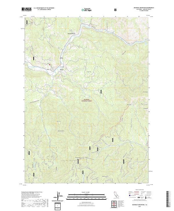
2021 Map of McKinley Mountain
USGS Topo · Published 2021About this map
The Klamath River flows through the northern reaches of this Siskiyou County landscape, which is largely defined by the Klamath National Forest. Named bars along the river, including Eagles Nest Bar and Round Bar, suggest the region's historic relationship with the water. The settlement of Walker and the clearing at Cedar Flat provide human anchors in a terrain characterized by deep gulches and significant peaks. To the south, the Scott Bar Mountains rise towards McKinley Mtn and Deadwood Baldy Peak. These highlands are connected by traditional routes such as the Humbug 97 Trl and Humbug 94 Trl, which navigate the complex drainage systems of Elmo Gulch and Lashes Gulch. The map records a wilderness still shaped by its drainage basins, from Little Barkhouse Gulch to the heights of Craggy Mtn.
Find a feature on this map
51 named features on this map. Tap any name to fly to it.
Don’t see what you’re looking for? This feature index may not catch every label — zoom into the map to look around manually.
Map Details
Editions of this 2021 McKinley Mountain Map
This is the sole edition of this map. No revisions or reprints were ever made.
Other maps of this area

1886 · Shasta
USGS Topo · 1:250,000

1894 · Shasta
USGS Topo · 1:250,000

1932 · Yreka
USGS Topo · 1:96,000

1939 · Yreka
USGS Topo · 1:125,000

1948 · Weed
USGS Topo · 1:250,000

1950 · Weed
USGS Topo · 1:250,000

1954 · Yreka
USGS Topo · 1:62,500

1955 · Condrey Mtn
USGS Topo · 1:62,500
1955 · Hornbrook
USGS Topo · 1:62,500
1955 · Fort Jones
USGS Topo · 1:62,500