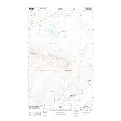
2013 Map of McKinley
USGS Topo · Published 2013About this map
Pike Mountain and the Laurentian Divide define the rugged topography of this Iron Range quadrangle in Saint Louis County. The landscape is heavily shaped by its industrial heritage, evident in the extensive Inland Steel Tailings Basin, Sauntry Creek Settling Basin, and the McKinley Tailings Basin located near the town of McKinley. These features reflect a legacy of open-pit mining operations that once drove the local economy. The settlement pattern follows the mineral-rich veins of the Mesabi Range, with towns like Elcor, Gilbert, and Biwabik dotting the map. Natural hydrology remains prominent despite the industrial footprints, as seen in the winding course of the Pike River and smaller bodies of water like Lola Lake and White Lake. Within the Superior National Forest, the map also identifies local landmarks such as the Florenton Cem and the Belgrade Cave near the Belgrade settlement.
Find a feature on this map
33 named features on this map. Tap any name to fly to it.
Don’t see what you’re looking for? This feature index may not catch every label — zoom into the map to look around manually.
Map Details
Editions of this 2013 McKinley Map
This is the sole edition of this map. No revisions or reprints were ever made.
Other maps of this area

1950 · Biwabik
USGS Topo · 1:24,000

1950 · Mc Kinley
USGS Topo · 1:24,000

1950 · Biwabik NW
USGS Topo · 1:24,000

1950 · Biwabik NE
USGS Topo · 1:24,000

1951 · Biwabik
USGS Topo · 1:24,000

1951 · Mc Kinley
USGS Topo · 1:24,000

1951 · Biwabik NE
USGS Topo · 1:24,000

1951 · Biwabik NW
USGS Topo · 1:24,000

1951 · Palo
USGS Topo · 1:24,000

1951 · Gilbert
USGS Topo · 1:24,000