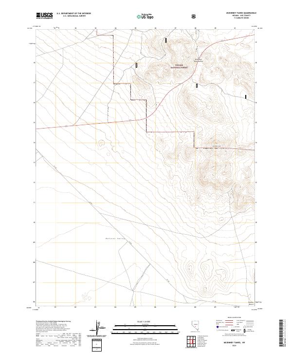
2021 Map of McKinney Tanks
USGS Topo · Published 2021About this map
Toiyabe National Forest dominates the northern and eastern portions of this Nye County landscape, where the terrain rises toward significant high points like McKinney Tanks Summit and the distinctive Hannapah Peak. The topography is defined by the transition from these elevated forest lands into the broad, arid expanse of the Ralston Valley and the Ralston Desert to the south. This 2021 survey illustrates a sparsely settled region of Nevada where human activity is primarily represented by the path of A R 504, which cuts diagonally across the valley floor. The map provides a clear record of the modern boundaries for T3N and T2N, showing how these administrative survey lines overlay the natural desert floor and the montane sections of the national forest.
Find a feature on this map
10 named features on this map. Tap any name to fly to it.
Don’t see what you’re looking for? This feature index may not catch every label — zoom into the map to look around manually.
Map Details
Editions of this 2021 McKinney Tanks Map
This is the sole edition of this map. No revisions or reprints were ever made.
Other maps of this area

1907 · Tonopah
USGS Topo · 1:250,000

1908 · Kawich
USGS Topo · 1:250,000

1908 · Lida
USGS Topo · 1:250,000

1908 · Tonopah
USGS Topo · 1:250,000

1913 · Lida
USGS Topo · 1:250,000

1942 · Cactus Range
USGS Topo · 1:125,000

1945 · Goldfield
USGS Topo · 1:125,000

1952 · Mud Lake
USGS Topo · 1:62,500

1952 · Cactus Peak
USGS Topo · 1:62,500

1954 · Goldfield
USGS Topo · 1:250,000