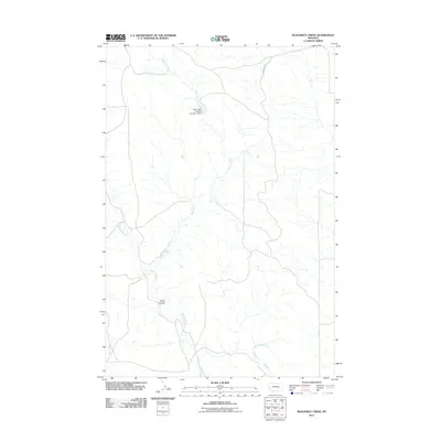
2011 Map of McKonkey Creek
USGS Topo · Published 2011About this map
Willow Creek meanders through this portion of Rosebud County, defining a landscape shaped by intermittent watercourses and ranching infrastructure. This high-plains environment is characterized by its drainage network, where Muggins Creek and McKonkey Creek converge toward larger basins. The presence of the Big Timber Livestock Number 1 Dam indicates the vital importance of water management for local agriculture and livestock in this arid Montana terrain. Topographic variations are marked by features such as Bone Coulee, providing a clear view of the erosion patterns typical of the region. The primary transportation artery, Ingomar Rd, cuts across the northern section, linking this sparsely populated ranching country to the small communities that dot the northern Montana plains.
Find a feature on this map
6 named features on this map. Tap any name to fly to it.
Don’t see what you’re looking for? This feature index may not catch every label — zoom into the map to look around manually.
Map Details
Editions of this 2011 McKonkey Creek Map
This is the sole edition of this map. No revisions or reprints were ever made.
Other maps of this area

1954 · Forsyth
USGS Topo · 1:250,000

1957 · Forsyth
USGS Topo · 1:250,000

1958 · Forsyth
USGS Topo · 1:250,000

1960 · Steie Ranch
USGS Topo · 1:24,000

1960 · Myers
USGS Topo · 1:24,000

1960 · Rancher Cemetery
USGS Topo · 1:24,000

1960 · Ingomar West
USGS Topo · 1:24,000

1960 · Ingomar East
USGS Topo · 1:24,000

1960 · Mc Konkey Creek
USGS Topo · 1:24,000

1962 · Sumatra
USGS Topo · 1:24,000