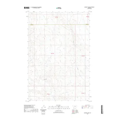
2020 Map of McKonkey Creek
USGS Topo · Published 2020About this map
Bone Coulee and the drainage basin of McKonkey Cr define this ranching landscape along the border of Rosebud and Treasure Counties. The area is characterized by high plains terrain where seasonal watercourses like Muggins Cr and Willow Cr have carved out the local topography. This modern survey reflects the enduring spatial organization of the Public Land Survey System, showing several townships including T8N R34E and T8N R35E. The primary transportation artery is Ingomar Rd, which provides access across the open range and connects the isolated hills and coulees that have served as landmarks for generations of land users in this part of eastern Montana.
Find a feature on this map
12 named features on this map. Tap any name to fly to it.
Don’t see what you’re looking for? This feature index may not catch every label — zoom into the map to look around manually.
Map Details
Editions of this 2020 McKonkey Creek Map
This is the sole edition of this map. No revisions or reprints were ever made.
Other maps of this area

1954 · Forsyth
USGS Topo · 1:250,000

1957 · Forsyth
USGS Topo · 1:250,000

1958 · Forsyth
USGS Topo · 1:250,000

1960 · Steie Ranch
USGS Topo · 1:24,000

1960 · Myers
USGS Topo · 1:24,000

1960 · Rancher Cemetery
USGS Topo · 1:24,000

1960 · Ingomar West
USGS Topo · 1:24,000

1960 · Ingomar East
USGS Topo · 1:24,000

1960 · Mc Konkey Creek
USGS Topo · 1:24,000

1962 · Sumatra
USGS Topo · 1:24,000