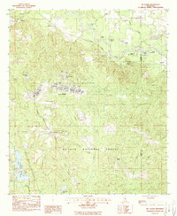
1983 Map of McLaurin
USGS Topo · Published 1990About this map
Camp Shelby dominates the central portion of this Forrest County landscape, situated within the sprawling boundaries of the De Soto National Forest. The military installation and its adjacent Hagler AAF Airport are surrounded by a network of small settlements such as McLaurin, Ralston, and McCallum. These communities are connected by the Illinois Central Gulf railroad, which follows the natural corridor of the region. To the north, the Leaf River winds through the terrain, creating distinctive features like Scott Bend and the Upper Dead River oxbow.
Find a feature on this map
52 named features on this map. Tap any name to fly to it.
Don’t see what you’re looking for? This feature index may not catch every label — zoom into the map to look around manually.
Map Details
Editions of this 1983 McLaurin Map
3 editions found
Other maps of this area

1947 · New Augusta
USGS Topo · 1:62,500

1949 · New Augusta
USGS Topo · 1:62,500

1953 · Hattiesburg
USGS Topo · 1:250,000

1958 · Hattiesburg
USGS Topo · 1:250,000

1963 · Rock Hill
USGS Topo · 1:24,000

1964 · Carterville
USGS Topo · 1:24,000

1964 · Ovett SE
USGS Topo · 1:24,000

1964 · Hattiesburg
USGS Topo · 1:24,000

1965 · Dixie
USGS Topo · 1:24,000
1983 · McLaurin
USGS Topo · 1:24,000