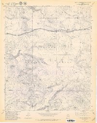
1979 Map of McLellan Reservoir
USGS Topo · Published 1979About this map
Kaibab National Forest dominates this northern Arizona landscape, where high-plateau cattle ranching and heavy rail transport converge. In the late 1970s, the Atchison Topeka and Santa Fe railroad cut across the northern terrain, passing through Sereno and tracing the edge of the Johnson Canyon rim. An earlier era of transit is visible in the Old Railroad Grade that winds through the brush north of the modern tracks.
Find a feature on this map
116 named features on this map. Tap any name to fly to it.
Don’t see what you’re looking for? This feature index may not catch every label — zoom into the map to look around manually.
Map Details
Editions of this 1979 McLellan Reservoir Map
4 editions found
Other maps of this area

1886 · Chino
USGS Topo · 1:250,000

1891 · Chino
USGS Topo · 1:250,000

1922 · Williams
USGS Topo · 1:125,000

1947 · Ash Fork
USGS Topo · 1:62,500

1948 · Ash Fork
USGS Topo · 1:63,360

1948 · Williams
USGS Topo · 1:250,000

1949 · Ash Fork
USGS Topo · 1:62,500

1954 · Williams
USGS Topo · 1:250,000

1956 · Williams
USGS Topo · 1:250,000

1960 · Williams
USGS Topo · 1:250,000