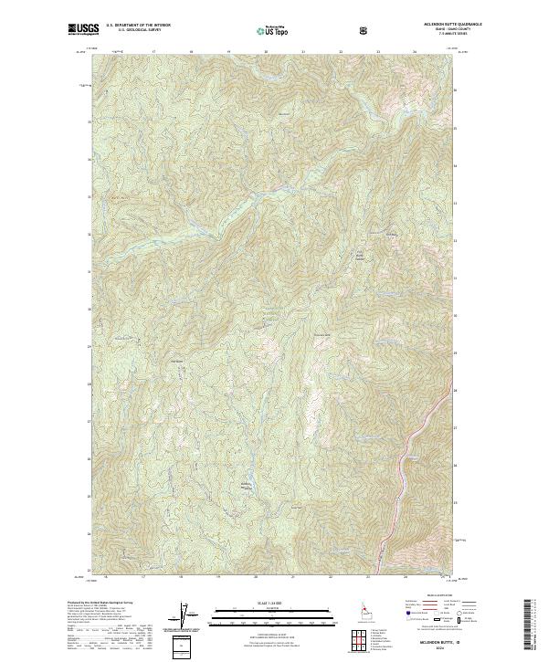
2024 Map of McLendon Butte
USGS Topo · Published 2024About this map
The Middle Fork Clearwater Wild and Scenic River carves through the southeastern corner of this Idaho County landscape, serving as a boundary for the protected Selway-Bitterroot Wilderness. This high-altitude terrain within the Clearwater National Forest is defined by a series of prominent summits including McLendon Butte, Fish Butte, and Mid Butte. The drainage patterns are complex, with waters like Hungery Creek, Fish Creek, and Bimerick Creek flowing through steep canyons and past local landmarks like Obia Point.
Find a feature on this map
37 named features on this map. Tap any name to fly to it.
Don’t see what you’re looking for? This feature index may not catch every label — zoom into the map to look around manually.
Map Details
Editions of this 2024 McLendon Butte Map
This is the sole edition of this map. No revisions or reprints were ever made.
Other maps of this area

1911 · Lolo
USGS Topo · 1:250,000

1913 · Lolo
USGS Topo · 1:250,000

1924 · Weippe
USGS Topo · 1:125,000

1956 · Hamilton
USGS Topo · 1:250,000

1959 · Hamilton
USGS Topo · 1:250,000

1960 · Hamilton
USGS Topo · 1:250,000

1964 · Hamilton
USGS Topo · 1:250,000

1966 · Lowell
USGS Topo · 1:24,000
1966 · Snowy Summit
USGS Topo · 1:24,000
1966 · Coolwater Mtn
USGS Topo · 1:24,000