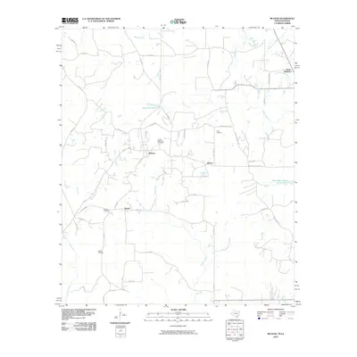
2010 Map of McLeod
USGS Topo · Published 2010About this map
McLeod and the surrounding borderlands of Cass County, Texas, and Caddo Parish, Louisiana, appear here as a landscape defined by small rural hubs and a network of county roads. The topography is shaped by slow-moving waterways, including Black Bayou and Boggy Creek, which feed into local catchments like Morses Mill Pond and Myrtis Mill Pond. This area reflects a quiet, dispersed settlement pattern typical of the piney woods region, where social life centered on locations like Walton and Rambo. For family historians, the presence of Good Exchange Cemetery, Josey Cemetery, and Bauguss Cemetery provides vital points of reference for tracing generations in this cross-border community. The industrial character of the era is evidenced by dedicated infrastructure such as United Gas No 1 Rd and United Gas No 2 Rd, highlighting the region's connection to energy production alongside its agricultural roots.
Find a feature on this map
51 named features on this map. Tap any name to fly to it.
Don’t see what you’re looking for? This feature index may not catch every label — zoom into the map to look around manually.
Map Details
Editions of this 2010 McLeod Map
This is the sole edition of this map. No revisions or reprints were ever made.
Other maps of this area

1907 · Atlanta
USGS Topo · 1:62,500

1910 · Atlanta
USGS Topo · 1:62,500

1932 · Hosston NW
USGS Topo · 1:31,680

1932 · Hosston SW
USGS Topo · 1:31,680

1944 · Kildare
USGS Topo · 1:62,500

1948 · Kildare
USGS Topo · 1:62,500

1948 · Vivian
USGS Topo · 1:62,500

1952 · Doddridge
USGS Topo · 1:24,000

1953 · Texarkana
USGS Topo · 1:250,000

1953 · El Dorado
USGS Topo · 1:250,000