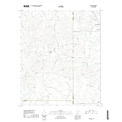
2019 Map of McLeod
USGS Topo · Published 2019About this map
McLeod and Rodessa anchor this survey of the borderlands where Texas and Louisiana meet. The landscape is defined by the drainage basins of Hurricane Cr and Clear Cr, feeding into Morses Mill Pond and the extensive wetlands of Black Bayou. The infrastructure of the local energy industry is visible through specialized routes like United Gas Road 1 and United Gas No 2 Rd, which cut through the timbered terrain alongside established settlements like Walton and Zylks. Local history is preserved in a network of rural burial grounds, including Good Exchange Cem, Josey Cem, and Rambo Cem. The map provides a detailed view of the complex jurisdictional boundary where Cass Co and Marion Co, Texas, meet Caddo Parish, Louisiana, a region shaped by both its natural hydrology and its industrial development.
Find a feature on this map
78 named features on this map. Tap any name to fly to it.
Don’t see what you’re looking for? This feature index may not catch every label — zoom into the map to look around manually.
Map Details
Editions of this 2019 McLeod Map
This is the sole edition of this map. No revisions or reprints were ever made.
Other maps of this area

1907 · Atlanta
USGS Topo · 1:62,500

1910 · Atlanta
USGS Topo · 1:62,500

1932 · Hosston NW
USGS Topo · 1:31,680

1932 · Hosston SW
USGS Topo · 1:31,680

1944 · Kildare
USGS Topo · 1:62,500

1948 · Kildare
USGS Topo · 1:62,500

1948 · Vivian
USGS Topo · 1:62,500

1952 · Doddridge
USGS Topo · 1:24,000

1953 · Texarkana
USGS Topo · 1:250,000

1953 · El Dorado
USGS Topo · 1:250,000