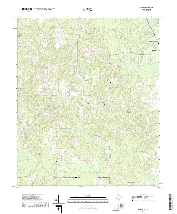
2022 Map of McLeod
USGS Topo · Published 2022About this map
McLeod sits at the heart of this East Texas and North Louisiana border region, where the piney woods are divided by the state line. The landscape is defined by the winding paths of Hurricane Cr, Frazier Cr, and Hunts Cr, which cut through the undulating terrain. A high density of local cemeteries and country churches, such as Walnut Hill Church Cem and the Pleasant Hope Primitive Baptist Cem, indicates a long-standing rural community structure. Near the settlement of Walton, the topography levels out toward the Caddo Parish line, while industrial footprints appear in the form of United Gas No 1 Rd, suggesting the ongoing influence of the regional energy sector. The map also captures the northern edge of Vivian and the community of Rodessa, illustrating the interconnectedness of these border-town economies along the Texas-Louisiana frontier.
Find a feature on this map
89 named features on this map. Tap any name to fly to it.
Don’t see what you’re looking for? This feature index may not catch every label — zoom into the map to look around manually.
Map Details
Editions of this 2022 McLeod Map
This is the sole edition of this map. No revisions or reprints were ever made.
Other maps of this area

1907 · Atlanta
USGS Topo · 1:62,500

1910 · Atlanta
USGS Topo · 1:62,500

1932 · Hosston NW
USGS Topo · 1:31,680

1932 · Hosston SW
USGS Topo · 1:31,680

1944 · Kildare
USGS Topo · 1:62,500

1948 · Kildare
USGS Topo · 1:62,500

1948 · Vivian
USGS Topo · 1:62,500

1952 · Doddridge
USGS Topo · 1:24,000

1953 · Texarkana
USGS Topo · 1:250,000

1953 · El Dorado
USGS Topo · 1:250,000