2011 Map of McLeod
USGS Topo · Published 2011About this map
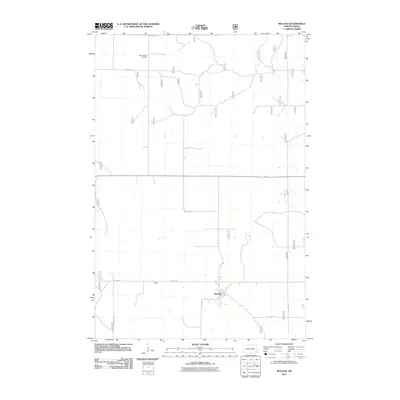
McLeod serves as the primary focal point of this Sheyenne Township survey, situated in the southeast quadrant where local routes like 70th St SE and 149th Ave SE converge. The landscape is defined by the rigid grid of the Public Land Survey System, which dictates the placement of rural infrastructure and agricultural boundaries. To the north, the Free Lutheran Cemetery remains a significant genealogical landmark, positioned along 64th St SE amidst a network of section-line roads such as 147th Ave SE. The geography is characterized by numerous small depressions and drainage patterns that punctuate the prairie, reflecting the glacial history of Richland County. This document preserves the late-twentieth-century rural footprint of the area before modern digital mapping became the standard, capturing the exact spatial relationship between isolated farmsteads and the community of McLeod.
Find a feature on this map
8 named features on this map. Tap any name to fly to it.
Don’t see what you’re looking for? This feature index may not catch every label — zoom into the map to look around manually.
Map Details
Editions of this 2011 McLeod Map
This is the sole edition of this map. No revisions or reprints were ever made.
Other maps of this area

1895 · Casselton
USGS Topo · 1:125,000

1897 · Casselton
USGS Topo · 1:125,000

1907 · Wyndmere
USGS Topo · 1:125,000

1953 · Fargo
USGS Topo · 1:250,000

1956 · Fargo
USGS Topo · 1:250,000

1960 · Wyndmere
USGS Topo · 1:24,000

1960 · Power
USGS Topo · 1:24,000

1960 · Wyndmere NW
USGS Topo · 1:24,000

1960 · Coburn
USGS Topo · 1:24,000

1960 · De Lamere
USGS Topo · 1:24,000