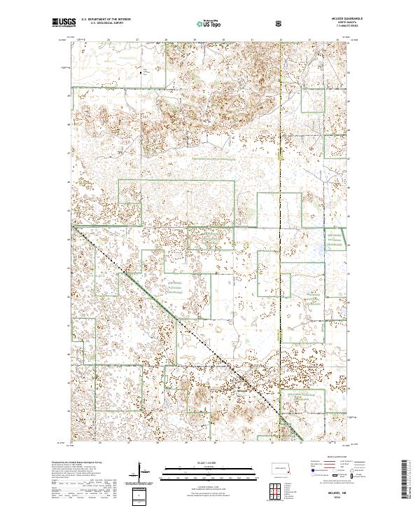
2024 Map of McLeod
USGS Topo · Published 2024About this map
McLeod sits at the heart of this modern survey of the North Dakota prairie, where the local grid of section lines meets the protected landscape of the Sheyenne National Grassland. The terrain is characterized by the complex wetland and dune patterns of the Red River Valley’s western edge, marked by numerous small depressions and drainage features. Cultural history is anchored by the Free Lutheran Cem in the northern portion of the map, while the North Country National Scenic Trl winds through the sand hills, offering a corridor through the native tallgrass prairie. This map captures the intersection of Ransom and Richland counties, showing how modern county roads like Co Rd 8 and 149th Ave SE connect the small community of McLeod to the surrounding agricultural and conservation lands.
Find a feature on this map
17 named features on this map. Tap any name to fly to it.
Don’t see what you’re looking for? This feature index may not catch every label — zoom into the map to look around manually.
Map Details
Editions of this 2024 McLeod Map
This is the sole edition of this map. No revisions or reprints were ever made.
Other maps of this area

1895 · Casselton
USGS Topo · 1:125,000

1897 · Casselton
USGS Topo · 1:125,000

1907 · Wyndmere
USGS Topo · 1:125,000

1953 · Fargo
USGS Topo · 1:250,000

1956 · Fargo
USGS Topo · 1:250,000

1960 · Wyndmere
USGS Topo · 1:24,000

1960 · Power
USGS Topo · 1:24,000

1960 · Wyndmere NW
USGS Topo · 1:24,000

1960 · Coburn
USGS Topo · 1:24,000

1960 · De Lamere
USGS Topo · 1:24,000