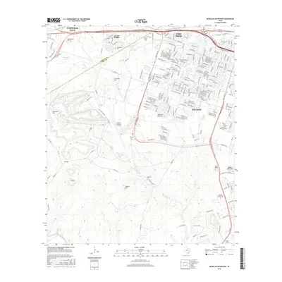
2016 Map of McMillan Mountains
USGS Topo · Published 2016About this map
McMillan Mountains rise above a landscape defined by the intersection of military activity and suburban expansion in Central Texas. This 2016 survey shows the edge of Fort Hood and the Robert Gray Army Airfield bordering the residential growth of Killeen and Copperas Cove. While modern developments like Kay Bee Heights and Central Texas Coll signal the area's current character, several historical markers remain. Numerous small burial grounds, including Henderson Cem, Sibley Cem, and Mayberry Cem, are scattered across the terrain near Reese Cr and N Reese Cr. The rugged southern topography is punctuated by prominent peaks such as Ivy Mtn, Manere Mtn, and Bald Knob, while the Lampasas River flows across the southwestern corner, offering a contrast to the heavily networked northern road systems.
Find a feature on this map
234 named features on this map. Tap any name to fly to it.
Don’t see what you’re looking for? This feature index may not catch every label — zoom into the map to look around manually.
Map Details
Editions of this 2016 McMillan Mountains Map
This is the sole edition of this map. No revisions or reprints were ever made.
Other maps of this area

1893 · Georgetown
USGS Topo · 1:125,000

1894 · Gatesville
USGS Topo · 1:125,000

1930 · Killeen
USGS Topo · 1:62,500

1947 · Fort Hood
USGS Topo · 1:62,500

1947 · Fort Hood
USGS Topo · 1:24,000

1947 · Post Oak Mountain
USGS Topo · 1:24,000

1947 · Killeen
USGS Topo · 1:62,500

1947 · McMillan Mountains
USGS Topo · 1:24,000

1947 · Killeen
USGS Topo · 1:24,000

1947 · Twin Moutains
USGS Topo · 1:24,000