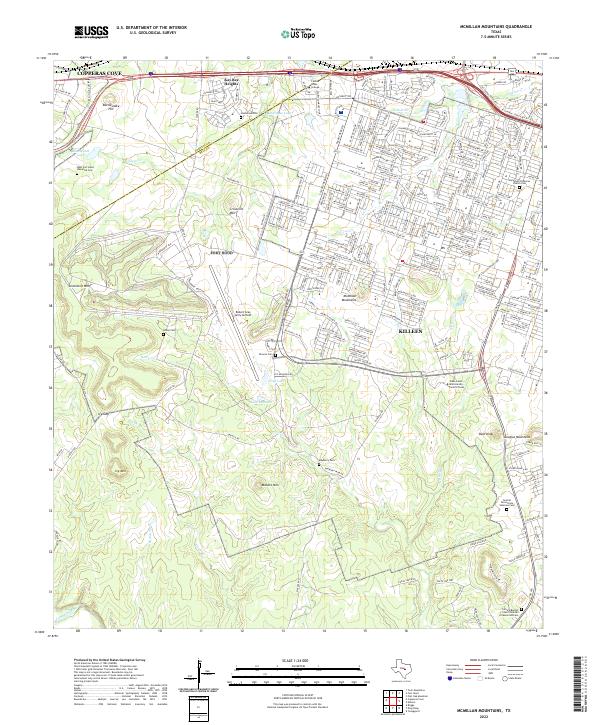
2022 Map of McMillan Mountains
USGS Topo · Published 2022About this map
McMillan Mountains and the rolling terrain of the Coryell and Bell Co line define this landscape, where military infrastructure and higher education meet. The expansive Robert Gray Army Airfield sits in the western portion of the quadrangle, south of the growing residential footprints of Copperas Cove and Kay Bee Heights. This contemporary survey illustrates the modern development patterns of Killeen, showing how institutional centers like Central Texas College and Texas A and M University Central Texas have become anchors for the region. Genealogists will find several burial sites including Mayberry Cem, Henderson Cem, and the sprawling Central Texas State Veterans Cem near the eastern edge. The topography is marked by distinctive elevations such as Manere Mtn, Sevenmile Mtn, and Bald Knob, while water flows through N Reese Cr and the Lampasas River along the southern border.
Find a feature on this map
250 named features on this map. Tap any name to fly to it.
Don’t see what you’re looking for? This feature index may not catch every label — zoom into the map to look around manually.
Map Details
Editions of this 2022 McMillan Mountains Map
This is the sole edition of this map. No revisions or reprints were ever made.
Other maps of this area

1893 · Georgetown
USGS Topo · 1:125,000

1894 · Gatesville
USGS Topo · 1:125,000

1930 · Killeen
USGS Topo · 1:62,500

1947 · Fort Hood
USGS Topo · 1:62,500

1947 · Fort Hood
USGS Topo · 1:24,000

1947 · Post Oak Mountain
USGS Topo · 1:24,000

1947 · Killeen
USGS Topo · 1:62,500

1947 · McMillan Mountains
USGS Topo · 1:24,000

1947 · Killeen
USGS Topo · 1:24,000

1947 · Twin Moutains
USGS Topo · 1:24,000