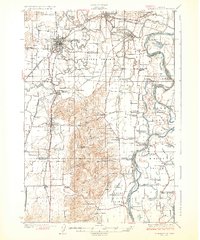
1926 Map of McMinnville
USGS Topo · Published 1926About this map
The Yamhill River winds through the heart of this valley, connecting the regional hub of McMinnville with the river-oriented settlements of Dayton and Lafayette. The landscape is defined by the fertile Dayton Prairie and the prominent Amity Hills, where early twentieth-century agriculture is supported by a dense network of local schools like Lone Star School and Fairview School. Near the eastern boundary, the Willamette River shapes the topography, creating the expansive Grand Island and the marshy Mission Bottom.
Find a feature on this map
79 named features on this map. Tap any name to fly to it.
Don’t see what you’re looking for? This feature index may not catch every label — zoom into the map to look around manually.
Map Details
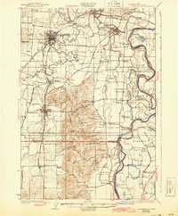
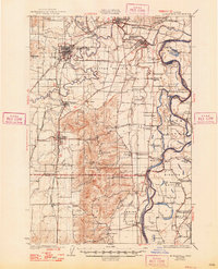
Editions of this 1926 McMinnville Map
4 editions found
Other maps of this area

1915 · Rickreall
USGS Topo · 1:31,680

1915 · Eola
USGS Topo · 1:31,680

1916 · Tualatin
USGS Topo · 1:62,500

1917 · Salem
USGS Topo · 1:62,500

1923 · Mount Angel
USGS Topo · 1:62,500

1924 · Mc Minnville
USGS Topo · 1:48,000

1925 · Stayton
USGS Topo · 1:62,500

1926 · Mc Minnville
USGS Topo · 1:62,500

1939 · Tualatin
USGS Topo · 1:62,500

1940 · McMinnville
USGS Topo · 1:62,500