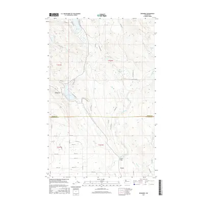
2017 Map of McMurray
USGS Topo · Published 2017About this map
McMurray and Bryant serve as the primary hubs in this corner of the Pacific Northwest, where the landscape is defined by a dense network of freshwater bodies and rising timberlands. Situated near the Skagit and Snohomish county line, the area features significant water resources including Big Lake, Lake McMurray, and the smaller Summer Lake. The presence of Finn Settlement Rd suggests the cultural legacy of early European arrivals who established homesteads among these drainage basins.
Find a feature on this map
51 named features on this map. Tap any name to fly to it.
Don’t see what you’re looking for? This feature index may not catch every label — zoom into the map to look around manually.
Map Details
Editions of this 2017 McMurray Map
This is the sole edition of this map. No revisions or reprints were ever made.
Other maps of this area

1911 · Mount Vernon
USGS Topo · 1:125,000

1940 · Mt Vernon
USGS Topo · 1:62,500

1941 · Marysville
USGS Topo · 1:62,500

1943 · Marysville
USGS Topo · 1:62,500

1943 · Mt Vernon
USGS Topo · 1:62,500

1943 · Stanwood
USGS Topo · 1:62,500

1944 · Clear Lake
USGS Topo · 1:62,500

1956 · Arlington West
USGS Topo · 1:24,000

1956 · Arlington East
USGS Topo · 1:24,000
1956 · Stanwood
USGS Topo · 1:24,000