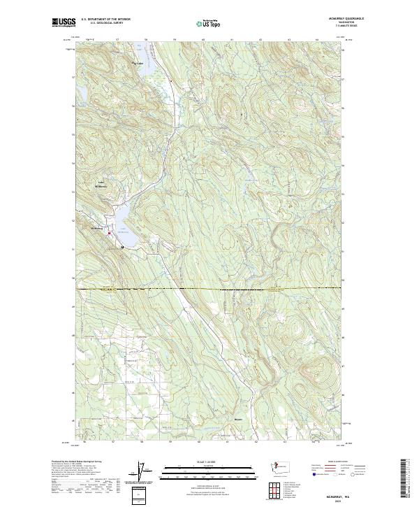
2023 Map of McMurray
USGS Topo · Published 2023About this map
Big Lake and the settlement of McMurray define this landscape along the Skagit and Snohomish county line. The map reveals a corridor of historical development following the natural north-south depressions of the land, anchored by the waters of Lake McMurray and Nookachamps Creek. The local geography is marked by residential growth along W Big Lake Blvd and the secluded waters of Summer Lake and Devils Lake. Researchers can locate the Lake McMurray Cem just south of the main townsite, providing a key point of interest for genealogical study. To the south, the community of Bryant sits near the banks of Pilchuck Creek, where the terrain transitions toward the Snohomish valley. The network of local roads like Finn Settlement Rd and Granstrom Rd suggests the legacy of early land claims and agricultural settlements that once populated these wooded valleys between the larger regional hubs.
Find a feature on this map
58 named features on this map. Tap any name to fly to it.
Don’t see what you’re looking for? This feature index may not catch every label — zoom into the map to look around manually.
Map Details
Editions of this 2023 McMurray Map
This is the sole edition of this map. No revisions or reprints were ever made.
Other maps of this area

1911 · Mount Vernon
USGS Topo · 1:125,000

1940 · Mt Vernon
USGS Topo · 1:62,500

1941 · Marysville
USGS Topo · 1:62,500

1943 · Marysville
USGS Topo · 1:62,500

1943 · Mt Vernon
USGS Topo · 1:62,500

1943 · Stanwood
USGS Topo · 1:62,500

1944 · Clear Lake
USGS Topo · 1:62,500

1956 · Arlington West
USGS Topo · 1:24,000

1956 · Arlington East
USGS Topo · 1:24,000
1956 · Stanwood
USGS Topo · 1:24,000