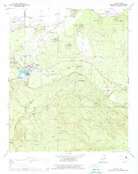
1976 Map of McNary
USGS Topo · Published 1977About this map
McNary serves as the focal point of this mid-1970s survey, situated along the Mogollon Rim within the Fort Apache Indian Reservation. The town's industrial and community infrastructure is well-defined, featuring an Athletic Field, multiple Cemeteries, and a Forestry Station. The surrounding landscape is a complex network of timber management and water resources, evidenced by numerous Old Railroad Grades and logging tracks like Upper Log Road that snake through the Sitgreaves National Forest.
Find a feature on this map
54 named features on this map. Tap any name to fly to it.
Don’t see what you’re looking for? This feature index may not catch every label — zoom into the map to look around manually.
Map Details
Editions of this 1976 McNary Map
This is the sole edition of this map. No revisions or reprints were ever made.
Other maps of this area

1886 · St Johns
USGS Topo · 1:250,000

1892 · St Johns
USGS Topo · 1:250,000

1954 · Clifton
USGS Topo · 1:250,000

1954 · Saint Johns
USGS Topo · 1:250,000

1957 · Clifton
USGS Topo · 1:250,000

1957 · Saint Johns
USGS Topo · 1:250,000

1958 · Clifton
USGS Topo · 1:250,000

1958 · Saint Johns
USGS Topo · 1:250,000

1961 · McNary
USGS Topo · 1:62,500

1962 · Clifton
USGS Topo · 1:250,000