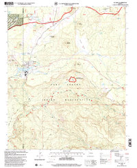
1998 Map of McNary
USGS Topo · Published 2000About this map
McNary sits at the northern edge of the Fort Apache Indian Reservation, where the high plateau gives way to the dramatic drop of the Mogollon Rim. The settlement pattern here reflects a mix of civic and industrial utility, featuring an Athletic Field, a local Cem, and a Substation. South of the main townsite, the Williams Creek National Fish Hatchery is a prominent installation along the creek, illustrating the region's managed aquatic resources at the end of the twentieth century.
Find a feature on this map
58 named features on this map. Tap any name to fly to it.
Don’t see what you’re looking for? This feature index may not catch every label — zoom into the map to look around manually.
Map Details
Editions of this 1998 McNary Map
This is the sole edition of this map. No revisions or reprints were ever made.
Other maps of this area

1886 · St Johns
USGS Topo · 1:250,000

1892 · St Johns
USGS Topo · 1:250,000

1954 · Clifton
USGS Topo · 1:250,000

1954 · Saint Johns
USGS Topo · 1:250,000

1957 · Clifton
USGS Topo · 1:250,000

1957 · Saint Johns
USGS Topo · 1:250,000

1958 · Clifton
USGS Topo · 1:250,000

1958 · Saint Johns
USGS Topo · 1:250,000

1961 · McNary
USGS Topo · 1:62,500

1962 · Clifton
USGS Topo · 1:250,000