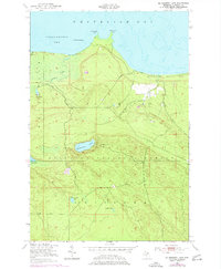
1951 Map of McNearney Lake
USGS Topo · Published 1977About this map
Hiawatha National Forest blankets this section of the Upper Peninsula, meeting the cold waters of Whitefish Bay and Tahquamenon Bay. The landscape is characterized by a high concentration of inland water bodies and coastal drainage systems, including Naomikong Lake, Piatt Lake, and the uniquely named Peek and Rye Lake. The survey details a largely undeveloped wilderness during the mid-20th century, where land management and fire observation were critical, as evidenced by the McNearney Lake Tower perched above McNearney Lake. Coastal features like Menekaunee Point and Naomikong Point define the shoreline, while the interior is traversed by limited access routes such as Lake Shore Drive and the Ibo Road. The map also includes portions of the Bay Mills area, illustrating the interplay between protected forest lands and the Great Lakes coastline.
Find a feature on this map
20 named features on this map. Tap any name to fly to it.
Don’t see what you’re looking for? This feature index may not catch every label — zoom into the map to look around manually.
Map Details
Editions of this 1951 McNearney Lake Map
3 editions found
Other maps of this area

1941 · Strongs
USGS Topo · 1:63,360

1951 · Strongs
USGS Topo · 1:24,000

1951 · McNearney Lake
USGS Topo · 1:24,000

1951 · Pendills Lake
USGS Topo · 1:24,000

1951 · Emerson
USGS Topo · 1:24,000

1951 · Piatt Lake
USGS Topo · 1:24,000

1951 · Sullivan Creek
USGS Topo · 1:24,000

1951 · Eckerman
USGS Topo · 1:24,000

1951 · Strongs
USGS Topo · 1:62,500

1951 · Eckerman
USGS Topo · 1:62,500